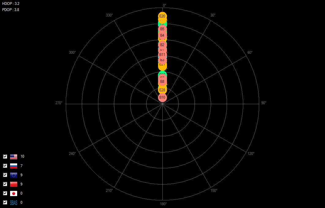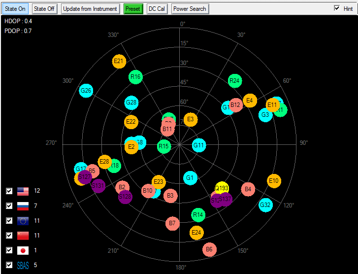
N7609B provides sky view display of simulated satellites, current latitude/longitude/altitude, PDOP/HDOP, satellite power, and simulated trajectory for moving scenarios, with pseudo-real-time updates (e.g. once per second).
The real-time sky view assists you to visualize what is happening in the scenario and simplifies result comparison reported by the GNSS receiver under test.
This view displays the location of all the visible satellites in the sky, from a receiver’s point of view. The view is displayed in a coordinate system based on [Azimuth, Elevation] and each satellite is placed at the proper position in the coordinate system. The location of the satellite will be updated in real-time as its elevation/azimuth is changing over time.
Move mouse over a particular satellite to display a tooltip, showing detailed real-time information about the satellite, including SV ID, Relative Power, Absolute Power, Pseudorange, Doppler shift and Multipath taps.
Instant DOP values (HDOP and PDOP) are shown at the left upper corner. The number of satellites for each constellation is displayed at the left lower corner in the view. Check or uncheck the constellation check boxes for different view requirements.
Sky view info is included in the scenario version later than Version 1.3. So for earlier version scenarios, the sky view will be similar to the view displayed as follows: